This Geocache can be found on its own, or as part of the series
that is placed within this section of land. You do not need to find
any others in order to find this one, and all of them utilize the
same parking location.
You can park your vehicle at N 43d 03.178’ x W 79d 16.229’
There are numerous ATV Trails throughout this area, however
there is no signage to indicated that ATV’s are permitted.
The text after this is for those wishing to complete the entire
series.
For most people, GPS Units and Satellites are basically some
strange black box that we have a minor understanding of how it
works, but most of the technical details are not really important.
As long as we can find our way, that’s good enough. The short
version is that GPS units determine our location based upon a
calculation of the distance we are away from Satellites that are in
orbit above the Earth. This is called Triangulation. Normally only
three Satellites are needed to determine a location, but the more
that are available the more accurate the GPS Unit becomes. However,
even with multiple Satellites, accuracy can vary around 5-10
meters.
This Geocache is one of four Satellite Geocaches. On the outside
of the container is the distance in meters that this location is
away from the GPS Unit. By using the distances found on some or all
of the Satellite Geocaches you will be able to find the GPS
Unit.
The remainder of this Geocache Description is purely for
historical or educational purposes. As such the rest of the
provided text will not assist you with finding any of the Geocaches
in the area.
The History of Satellites – TIROS-1
As copied from:
Frankins
Forecast – Satellite History
In 1947, an unmanned American rocket carried a camera into
outer space and recorded pictures of Earth from space. The pictures
showed how the atmosphere appeared from above. Cloud formations
were clearly visible. The pictures gave scientists proof that
weather observations could be made from space on a regular
basis.
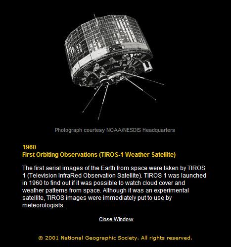
In 1960, the first weather satellite was launched into orbit
around planet Earth. Called TIROS, for Television InfraRed
Observational Satellite, it carried a video camera to make regular
observations of the atmosphere below. For the first time,
meteorologists were able to compare their localized ground-based
weather observations with broader pictures of the weather system.
Weather forecasting took a dramatic leap forward. After the initial
successes, nine more TIROS satellites were put into orbit during
the 1960s.
In 1966, the United States placed its first weather satellite
in high, geostationary orbit. Called ATS, for Applications
Technology Satellite, the satellite traveled at the same speed the
Earth rotates, appearing to remain stationary with respect to the
Earth below. From this geostationary orbit location 22,300 miles
above the equator, ATS took the first pictures showing a whole
hemisphere of the Earth at once. With ATS images, meteorologists
saw how clouds moved and storms formed over wide regions.
The development of satellite weather technology had an
enormous impact on the field of meteorology. The big pictures came
into focus, and weather forecasting became more accurate.
For more information regarding the History of Satellites, check
out
National
Geographic: Eye in the Sky
Hope you enjoy the cache - Please ensure that the geocache is
well hidden in the same location that it was found.
 The Blue Quasar
Cache Maintenance Performed On: 31 JUL 08
Details: Archived - Cache Container Removed
Thanks to all those that visited.

Click on
Weather Report for today's short term weather forecast before
you attempt this geocache.
Current weather conditions are:
This Geocache will be Archived on: 29 JUL 08
Any logs that contain SPOILERS will be
deleted without exception, and will have to be re-entered by the
seeker to be accepted.
This also applies to logs that contain content suggesting
inappropriate activity or do not conform to the guidelines as
listed on the Cache Page or no longer relevant.
Any needed assistance was included in the HINTS section, and was
provided by the Cache Owner.