This Geocache can be found on its own, or as part of the series
that is placed within this section of land. You do not need to find
any others in order to find this one, and all of them utilize the
same parking location.
You can park your vehicle at N 43d 03.178’ x W 79d 16.229’
There are numerous ATV Trails throughout this area, however
there is no signage to indicated that ATV’s are permitted.
The text after this is for those wishing to complete the entire
series.
For most people, GPS Units and Satellites are basically some
strange black box that we have a minor understanding of how it
works, but most of the technical details are not really important.
As long as we can find our way, that’s good enough. The short
version is that GPS units determine our location based upon a
calculation of the distance we are away from Satellites that are in
orbit above the Earth. This is called Triangulation. Normally only
three Satellites are needed to determine a location, but the more
that are available the more accurate the GPS Unit becomes. However,
even with multiple Satellites, accuracy can vary around 5-10
meters.
This Geocache is one of four Satellite Geocaches. On the outside
of the container is the distance in meters that this location is
away from the GPS Unit. By using the distances found on some or all
of the Satellite Geocaches you will be able to find the GPS
Unit.
The remainder of this Geocache Description is purely for
historical or educational purposes. As such the rest of the
provided text will not assist you with finding any of the Geocaches
in the area.
The History of Satellites – ERTS (aka LANDSAT)
As copied from:
The
Landsat Program – History
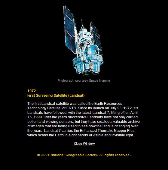
Landsat 1 was launched on July 23, 1972; at that time the
satellite was known as the Earth Resources Technology Satellite
(ERTS). It was the first Earth-observing satellite to be launched
with the express intent to study and monitor our planet's
landmasses.
"The ERTS spacecraft represent the first step in merging space
and remote-sensing technologies into a system for inventorying and
managing the Earth's resources."
- Dr. V. E. McKelvey
To perform the monitoring, Landsat 1 carried two instruments:
a camera system built by the Radio Corporation of America (RCA)
called the Return Beam Vidicon (RBV), and the Multispectral Scanner
(MSS) built by General Electric.
The RBV was supposed to be the prime instrument, but the MSS
data were found to be superior. In addition, the RBV instrument
caused an electrical transit that caused the satellite to briefly
lose altitude control, according to the Landsat 1 Program Manager,
Stan Weiland.
The MSS instrument was flown as the secondary and highly
experimental instrument.
"But once we looked at the data, the roles switched," relates
Stan Freden, Landsat 1 Project Scientist.
The MSS recorded data in four spectral bands—a green, red,
and two infrared bands. To help understand the data and to explore
the potential applications of this new technology, NASA oversaw 300
private research investigators. Nearly one third of these were
international scientists. These researchers came from a wide array
of Earth science disciplines. They evaluated the usefulness of
Landsat data to their respective fields.
In the foreword of the U.S. Geological Survey's "ERTS-1 A New
Window on Our Planet," published in 1976, then-director of the
USGS, Dr. V. E. McKelvey, wrote: "The ERTS spacecraft represent the
first step in merging space and remote-sensing technologies into a
system for inventorying and managing the Earth's
resources."
Landsat 1 operated until January 1978, outliving its design
life by five years. The Landsat 1 Multispectral Scanner acquired
over 300,000 images providing repeated coverage of the Earth's land
surfaces. The quality and impact of the resulting information
exceeded all expectations.
For more information regarding the History of Satellites, check
out
National
Geographic: Eye in the Sky
Hope you enjoy the cache - Please ensure that the geocache is
well hidden in the same location that it was found.
 The Blue Quasar
Cache Maintenance Performed On: 31 JUL 08
Details: Archived - Cache Container Removed
Thanks to all those that visited.

Click on
Weather Report for today's short term weather forecast before
you attempt this geocache.
Current weather conditions are:
This Geocache will be Archived on: 29 JUL 08
Any logs that contain SPOILERS will be
deleted without exception, and will have to be re-entered by the
seeker to be accepted.
This also applies to logs that contain content suggesting
inappropriate activity or do not conform to the guidelines as
listed on the Cache Page or no longer relevant.
Any needed assistance was included in the HINTS section, and was
provided by the Cache Owner.